Showing posts with label Maps. Show all posts

Wednesday, August 25, 2010

Street View Added to Building Maker

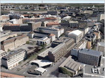
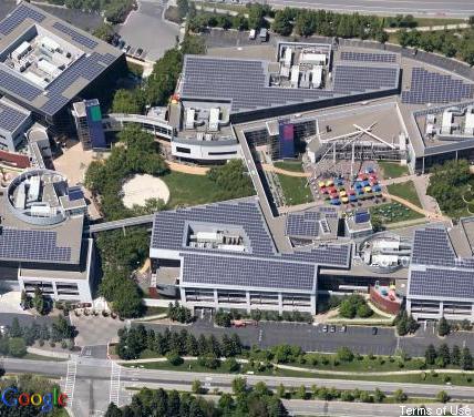
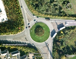
Neighborhood in Sapporo, Japan
Downtown in Helsinki, Finland
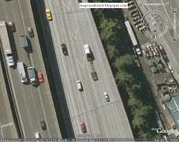
Business in Seattle, Washington US
Builder Maker  is a Google Earth, Google Maps And Google Aerial Imagery interface to help you create 3D models for Google Earth. But Now Google added  a Street View images to Google Builder Maker.
Now you can grab a Street View image, align it with your building and then use the image as the texture for the building.

watch the video below to see how it works :


Six new cities  added to Building Maker:

Edinburgh, United Kingdom
Florence, Italy
Vienna, Austria
Pittsburgh, PA, United States
Santa Cruz, CA, United States
Riverside, CA, United States

All The cities in Builder Maker have Google’s oblique aerial imagery. It is therefore a pretty good guide to which cities will have aerial views soon added to Google Maps and the Google Maps API.
Here’s a little something I put together to compare Bing Maps Birds Eye view with aerial view in Google Maps:


 Bird’s Eye View


Friday, March 5, 2010

Google maps add "Aerial Imagery"

When i went to google maps this morning it show me same new features .i chose to enable all new features.
one of its is  Aerial Imagery . it's realy a good feature . and here how it's look like :

View Larger Map

or you can use this link to see it on google maps

Sunday, January 3, 2010

Google Maps and Google Street View Project Supported by Toyota


Do you know what this picture is about?
Yes … the car is a Prius Hybrid vehicle by Toyota. The camera on top is Google’s. Toyota provided a fleet of Prius cars for Google’s Street View Project now underway in South Africa in preparation for World Cup.
Toyota published the press release announcing the project in September.
“The Prius with its Hybrid Synergy Drive technology was chosen by Google as the vehicle of choice for this project. In the coming weeks the branded Google Prius vehicles will be driving around the country taking photographs of locations in Johannesburg, Cape Town, Pretoria, Port Elizabeth and Durban. Street View, a hugely popular feature of Google Maps, is already available in more than 100 metropolitan areas around the world. It allows users to virtually explore and navigate a neighbourhood through panoramic street-level images. It is also available in Google Earth and on Google Maps for Mobile.”
This project will add considerable impetus to the use of Google Maps… and the move to Local Search.
Can you imagine the power that this application will provide and especially for mobile users?
It’s time I got myself a Smart Phone… don’t know about you?

Sunday, December 20, 2009

Google Map of Thai Real Estate


ReThai


ReThai uses the Google Maps API to show properties for sale or rent in Thailand. Anyone can advertise a property listing on the map for free by registering with the site. Real estate agents can even add a logo and business details to their properties added to ReThai.

It is possible to search for properties on the map by price range, property type and location. Clicking on a property's map marker opens an information window with information about the listing and direct contact details of the property's owner.

Monday, August 31, 2009

Google Maps: Firefox Logo Crop Circle

Google Maps: Firefox Logo Crop Circle


View Larger Map

Wednesday, July 22, 2009

Explore the Moon in Google Earth

After adding the ocean, the sky, Mars, Google Earth now has imagery from the Moon. Forty years after the Moon landing, you can explore the Earth's natural satellite in 3D.


"Each of the Apollo landing missions is chronicled in detail through pictures and stories. We've even embedded video footage from Spacecraft Films that covers the most well-known moments on the surface. There are also immersive lunar surface panoramas, composed of photos taken by the astronauts themselves, presented for the first time in a 3D Street View style interface," explains Google.


you need a recent version of Google Earth

Saturday, July 18, 2009

The Google Maps alphabet UK: an A to Z of the British Isles-E-

The letter E, from Berwick upon Tweed, Northumberland

The Google Maps alphabet UK: an A to Z of the British Isles-D-

"The major cities like London, Manchester and Liverpool I thought would be a safe bet for odd-shaped buildings," she said, "and being from Yorkshire I knew that would be a good place for fields and hedgerows"

The letter D, from White City, London

The Google Maps alphabet UK: an A to Z of the British Isles-C-

She spent five hours per day for three days using the satellite view on Google Maps to hunt down perfect images representing all 26 letters

The letter C, from Normanton on the Wolds, Nottinghamshire

Sunday, July 12, 2009

Simultaneous Searches in Google Maps

Now it's possible to see the results for multiple searches in Google Maps or you want to quickly switch to a recent query. Google Maps displays at the bottom of the page a list of recent searches and each layer of search results can be enabled independently. Google Maps uses different colors for the markers so you can differentiate the results

 
Clicky Web Analytics